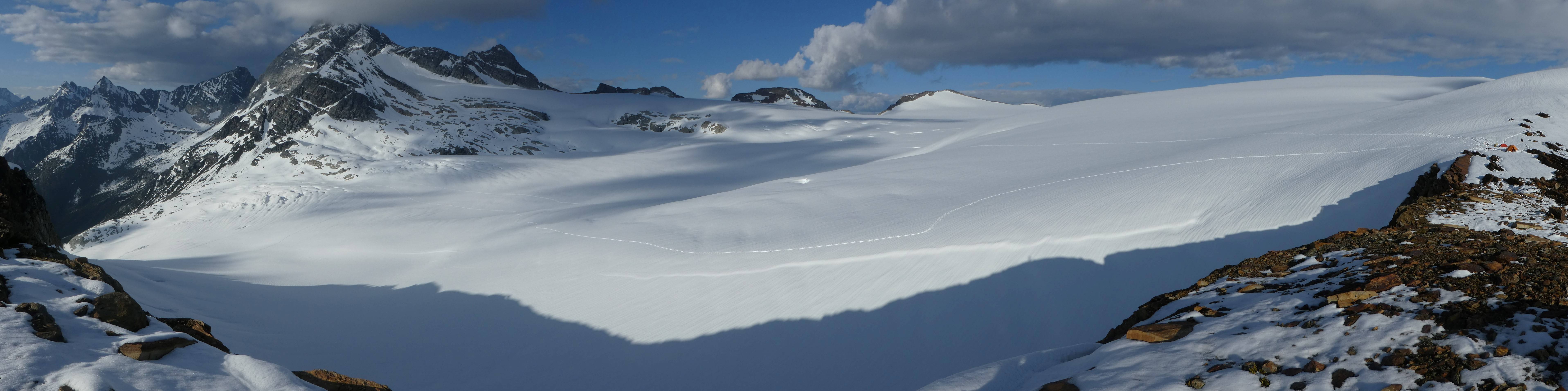
The panorama above shows ski tracks from towing the radar across Illecillewaet Glacier—starting from the camp on Lookout Mountain (far right) heading toward Mount Sir Donald, with its summit in the clouds.
Rationale
During the past ten years, Parks Canada has supported studies to monitor the state of and changes in the Illecillewaet Glacier. Measuring ice thickness provides insight into how much ice the Illecillewaet Glacier contains and contextualizes the current thinning of the glacier as measured annually by Parks Canada since 2009. Ice thickness data for the region is sparse; therefore, any contribution improves our understanding of how much ice exists in Glacier National Park and in the Columbia and Rocky Mountains of western Canada. Detailed regional estimates of glacier ice thickness foster better projections of the glacier response to climate change and the associated hydrologic implications of reduced glacier area.
Objectives
- To collect ground penetrating radar (GPR) data over the Illecillewaet Glacier.
- Process the radar data to map the ice thickness of the Illecillewaet Glacier.
Methods
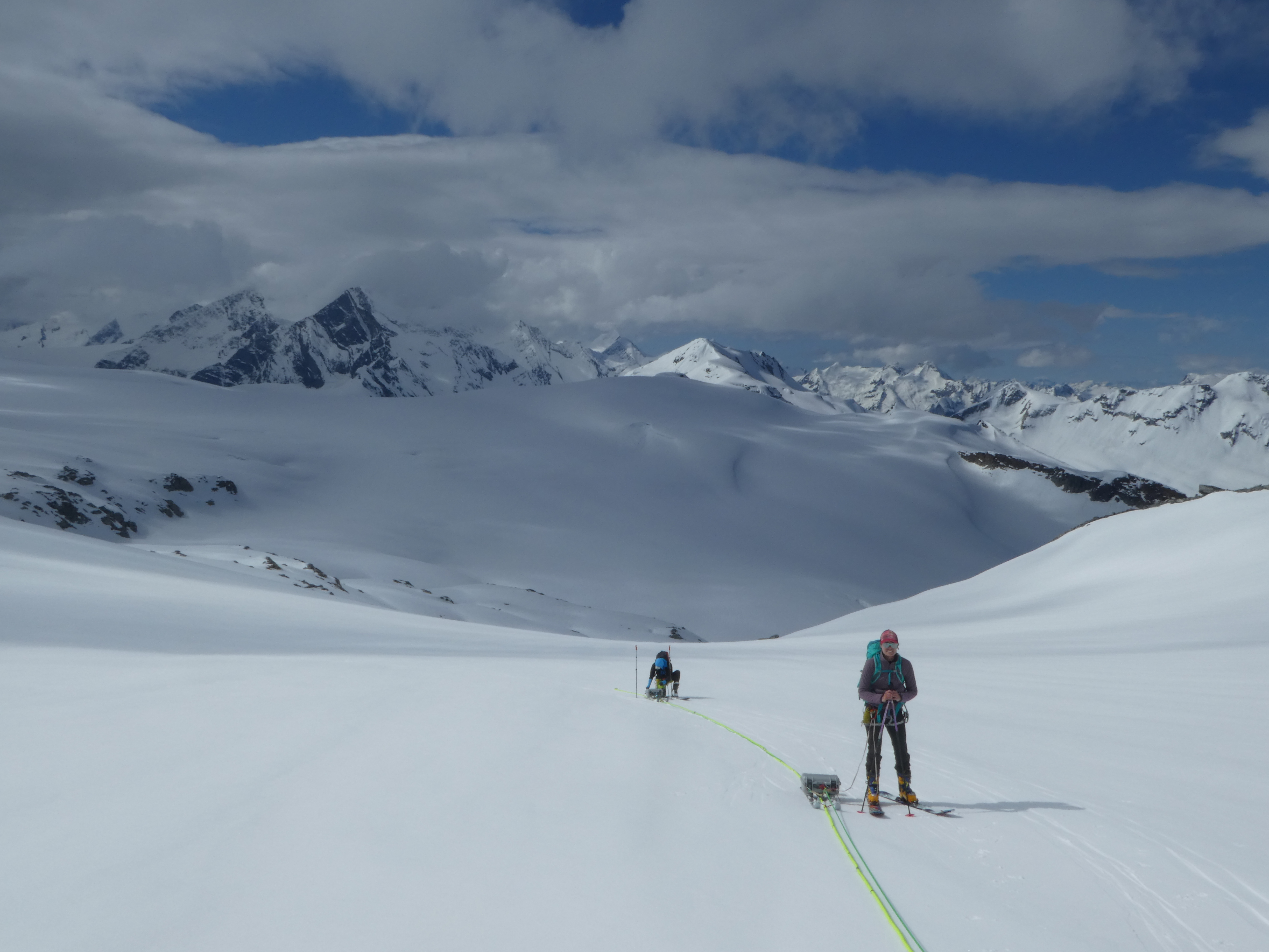
To obtain the ice thickness, GPR surveys were conducted in May 2016 and May 2018 on the Illecillewaet Glacier. A Blue Systems Integration radar system was used, employing 10 MHz center frequency antennas with an 1100 V transmitter. A team of four skiers operated the radar, pulling the sleds that housed both the receiving computer and transmitter. Ice thickness measurements were collected along longitudinal and cross-profiles approximately every 5 m. Data collection was dependent upon slope and other safety concerns. Ice thickness was extracted using IcePick software that incorporates the travel time of a radar wave through ice.
Results
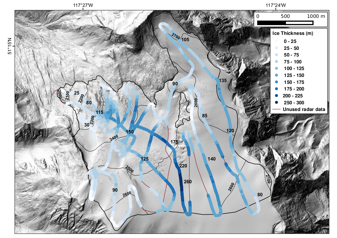
During the two survey visits, 41 km of ice thickness data over the glacier were collected, of which 38 km was successfully processed. As of 2018, the average ice thickness for the Illecillewaet Glacier was ~110 m. Maximum depth was 260 m, and minimum depth, near the glacier margin, was 8 m. Parks Canada plans to use the outcome of this work in future glacier monitoring and reporting.
Partners & Funding
University of Northern British Columbia, Parks Canada
This post was my entry in the Parks Canada report: “Mount Revelstoke and Glacier National Parks Resource Conservation Research and Monitoring Summary 2012–2018.